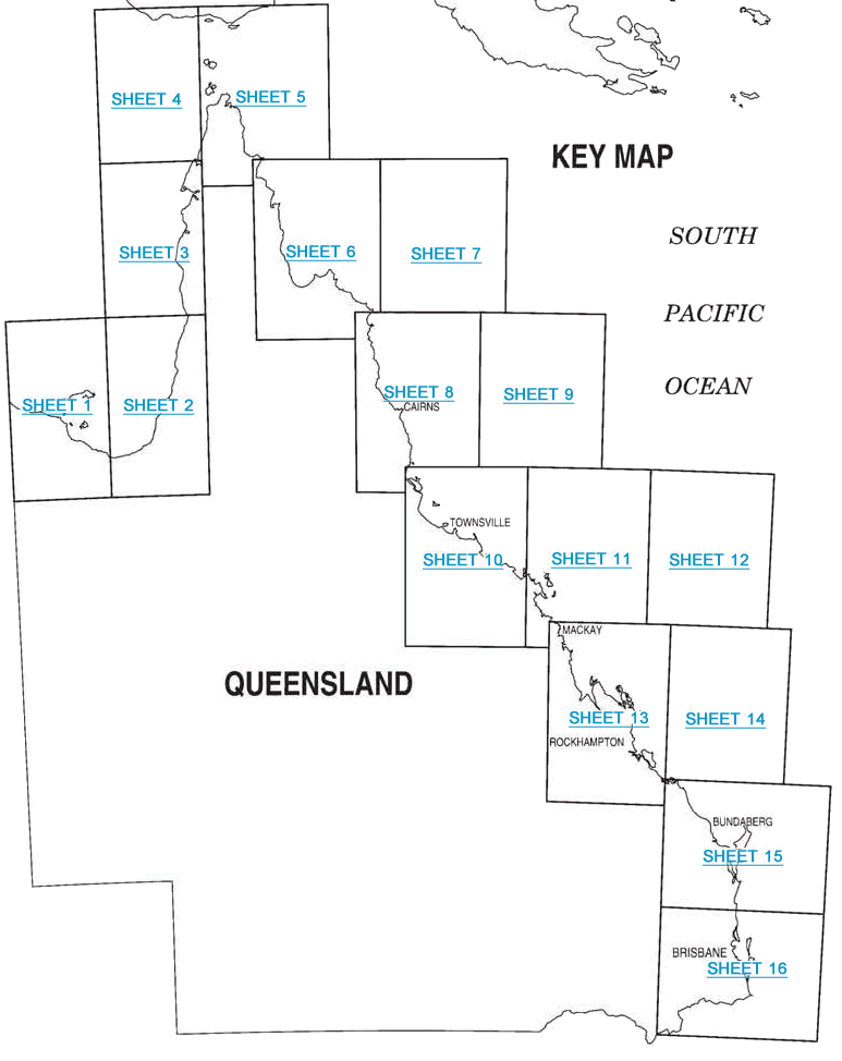
Logbook codes and maps
Queensland waterways are divided into 16 mapped areas. Each area has a location reference consisting of a grid and site (e.g. grid U38, site 13).
The commercial fisher in control must use the grid/site reference (or latitude and longitude) when completing the:
These maps are also found in the front of both logbooks.
Maps
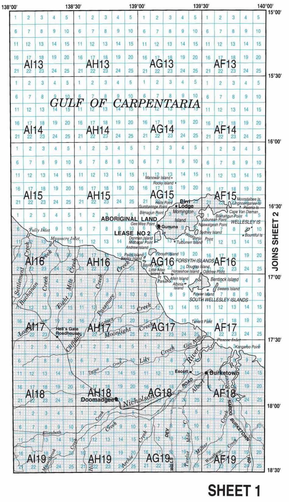
Sheet 1 covers part of the Gulf of Carpentaria.
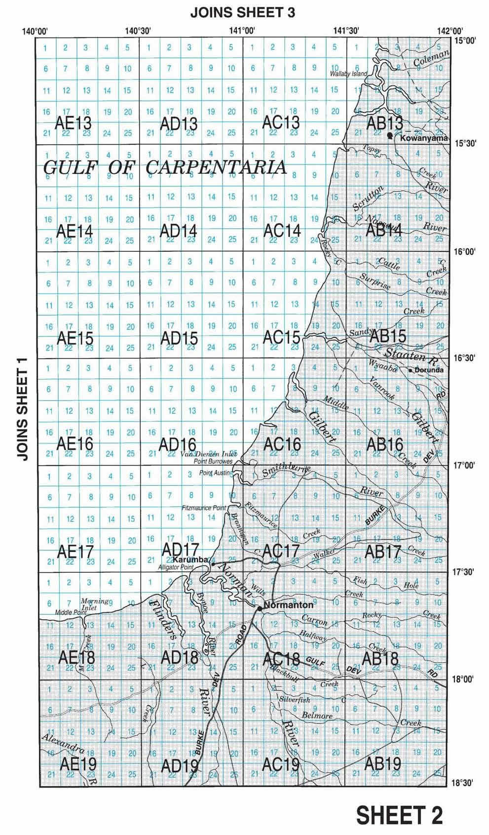
Sheet 2 covers part of the Gulf of Carpentaria.
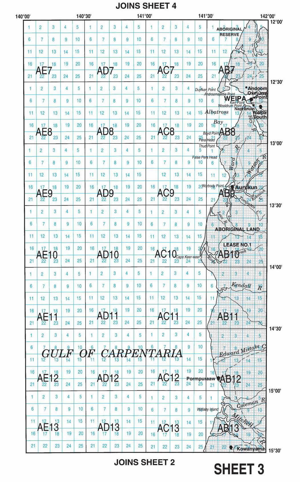
Sheet 3 sits above sheet 2, leading up the west coast of Cape York.
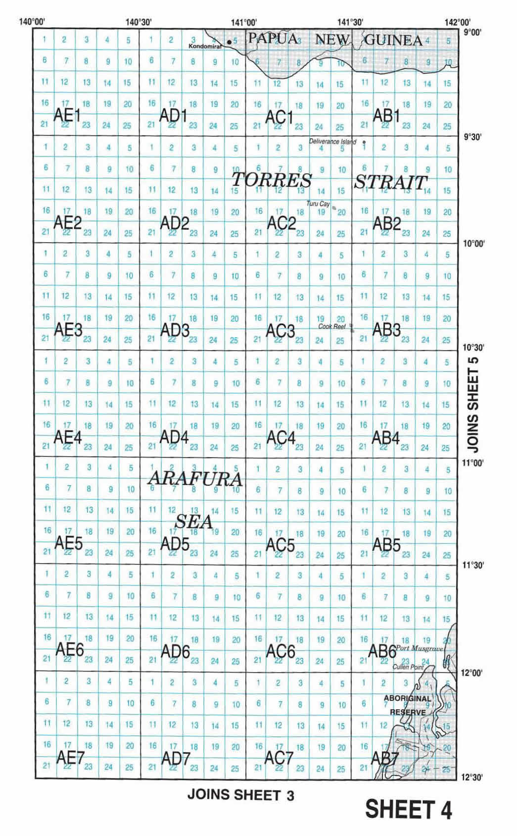
Sheet 4 sits above sheet 3, leading up to the waters just off Rocky Point and parallel to Thursday Island.
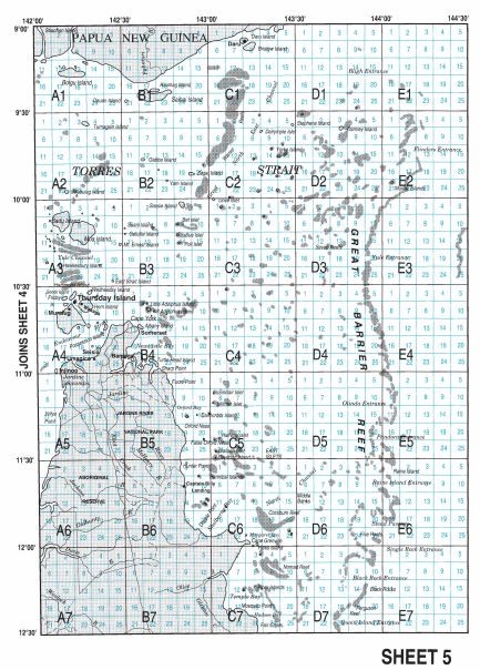
Sheet 5 covers the highest point of the state, including Thursday Island.
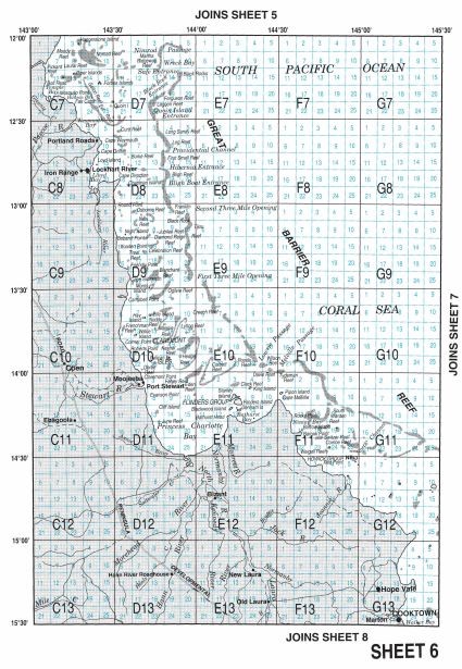
Sheet 6 covers inland areas from Lockheart River into just offshore.
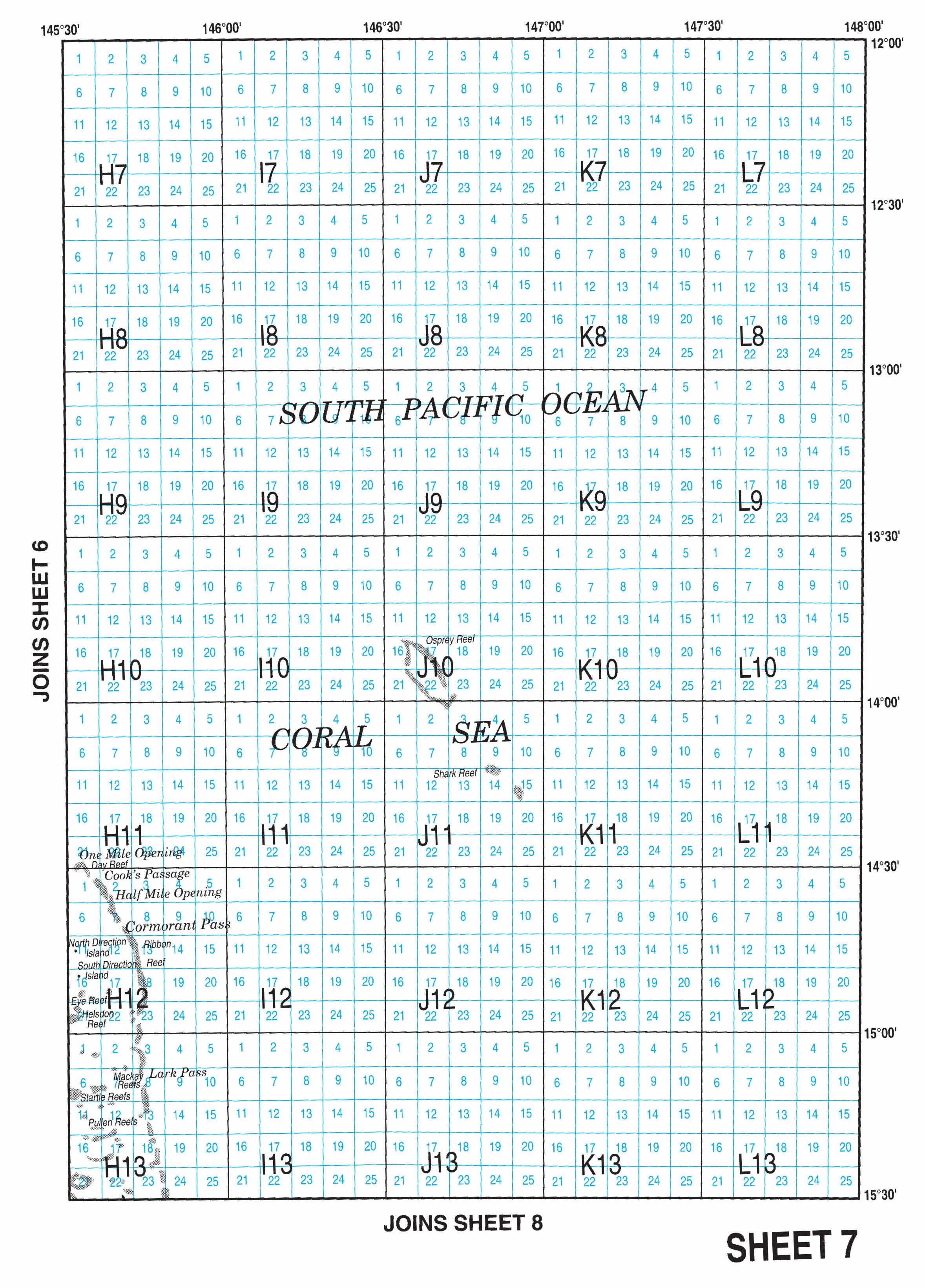
Sheet 7 sits parallel to sheet 6, in open waters further off the coast.
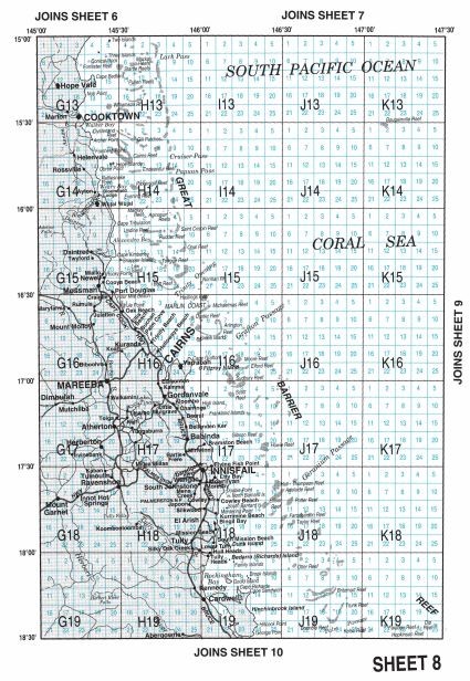
Sheet 8 covers some inland areas, including Cairns.
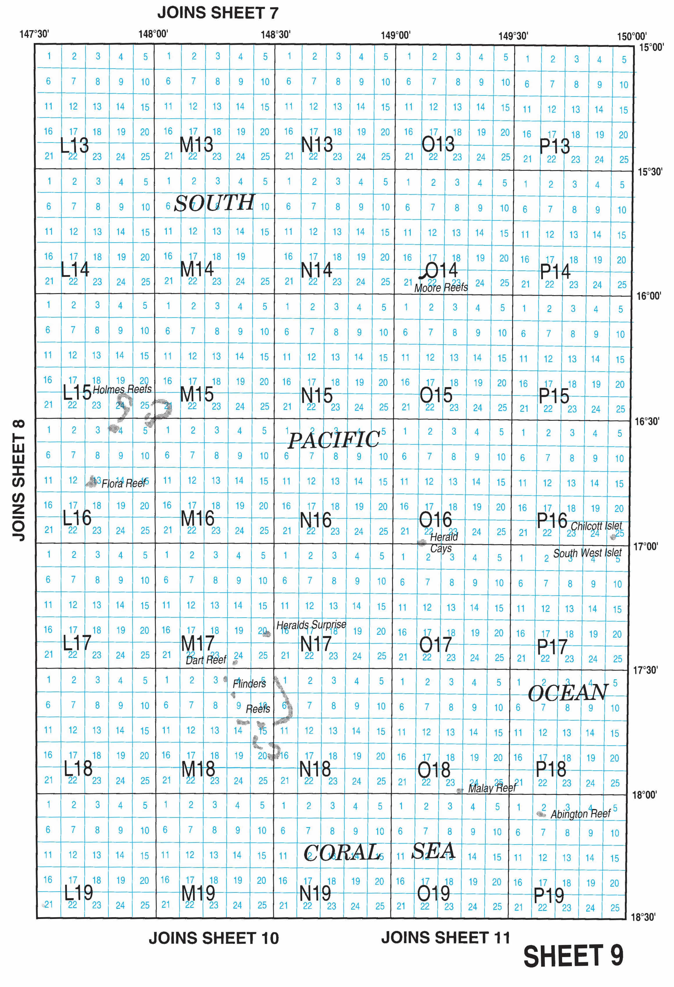
Sheet 9 is parallel to Sheet 8, in open waters.
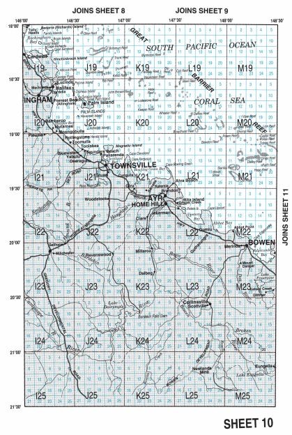
Sheet 10 begins just before Hinchenbrook Island and covers the coast around Townsville inland.
Sheet 11 is parallel to 10, but includes some inland area beginning around Bowen and the Whitsunday islands, with its area stopping at Mackay but extending into open waters out from the Townsville and Whitsunday coasts.
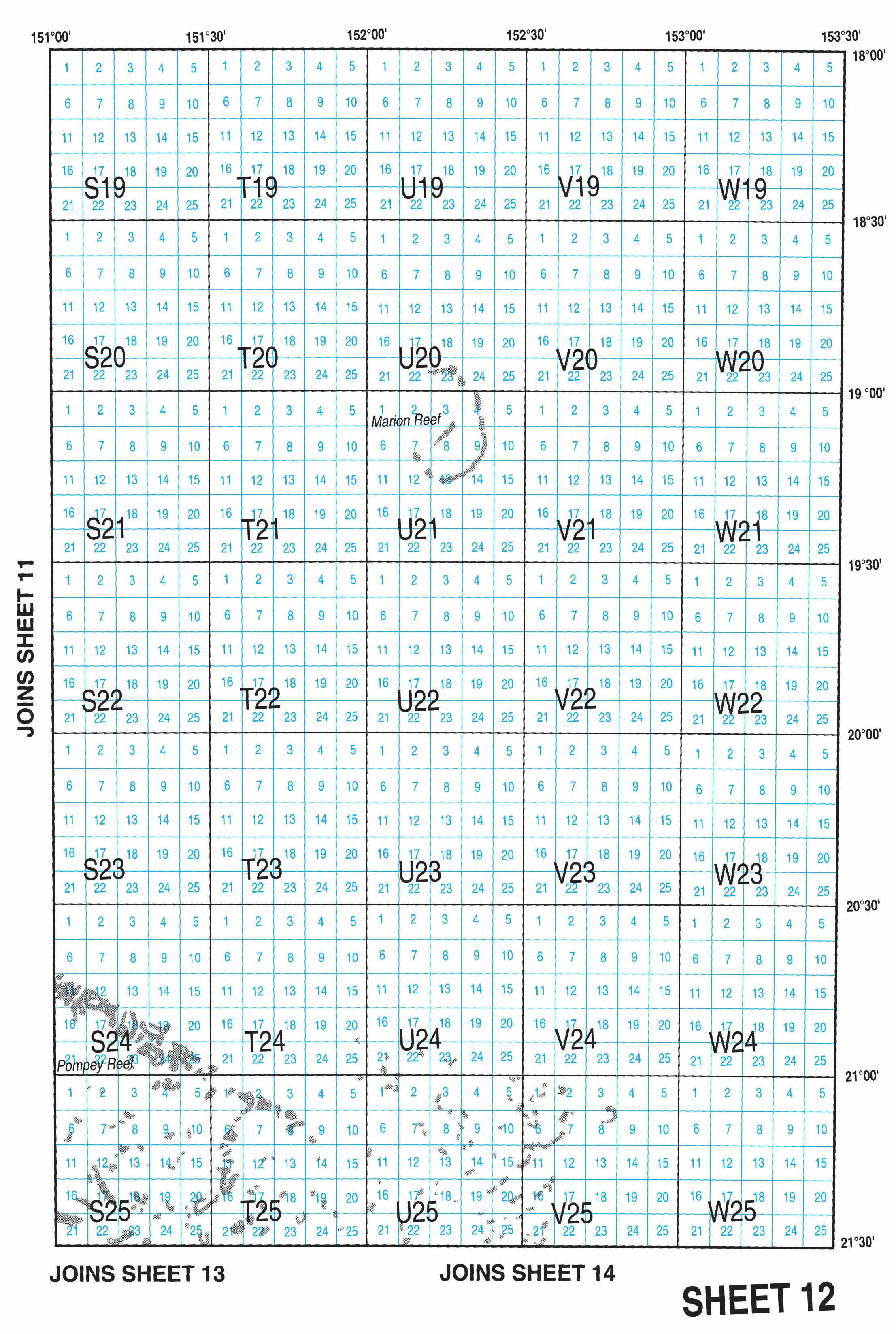
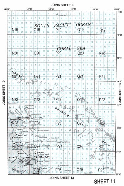
Sheet 12 is parallel to 11, covering a square area of open water.
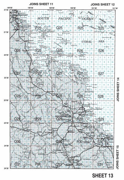
Sheet 13 begins just before Mackay and covers the coast and inland past Rockhampton to just past Camp Island near Agnes Water.
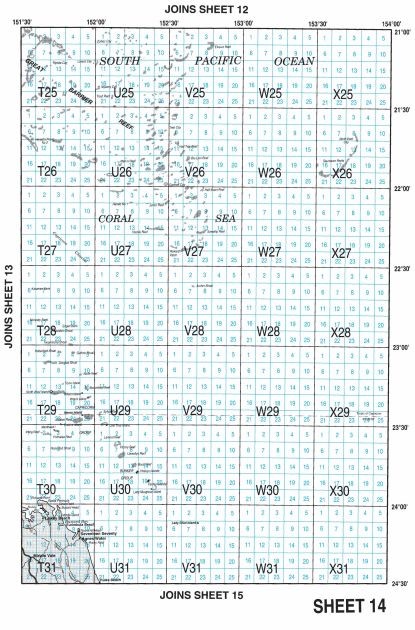
Sheet 14 sits parallel to 13, in open waters.
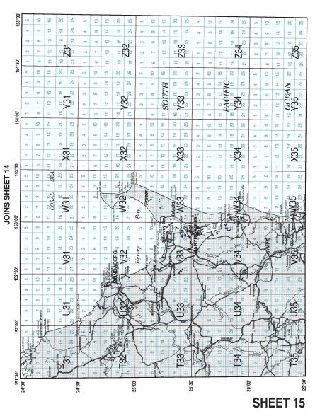
Sheet 15 covers inland and waters off the coast from about Agnes Water to the Sunshine Coast, with Bundaberg in the middle.
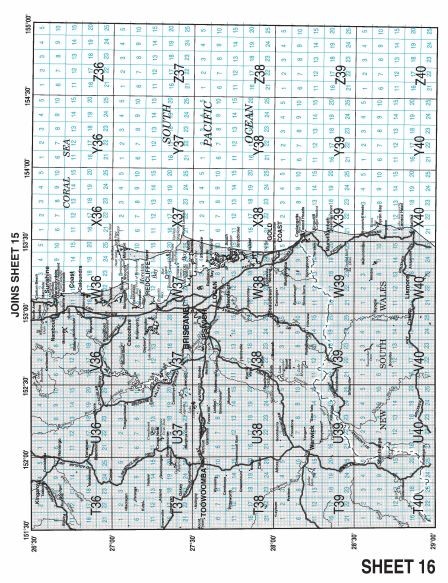
Sheet 16 covers the Sunshine Coast, inland and out into open waters around Brisbane down to the New South Wales border.